| Turn map |
Directions & comments |
|
|

Start.

Find the car park at the start.

After 35 m pass the sign (10 m on your right).
|
|
|

After another 15 m (at the intersection of Strickland Falls Trail & Cabbage Tree Trail) continue straight, to head along Cabbage Tree Trail.

Then find the "Banksia Picnic Area" (8 m on your right).
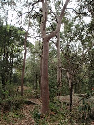
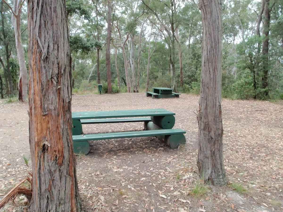
This picnic area is in the Strickland State Forest, on the NSW Central Coast. The facilities include picnic tables, pit toilets, BBQ fire places, garbage bins and tank water. A few bush walking tracks start from the picnic area.

After another 25 m come to the "Gosford Lookout" (20 m on your right).
|
|
|

After another 1.1 km (at the intersection of Cabbage Tree Trail & Stoney Creek Trail) veer left, to head along Stoney Creek Trail.

After another 440 m cross the ford.
|
|
|

After another 490 m (at the intersection of Arboretum Trail & Stoney Creek Trail) turn right, to head along Arboretum Trail.
After another 20 m cross the ford.
|
|
|
After another 420 m (at the intersection of Bellbird Trail & Arboretum Trail) continue straight, to head along Arboretum Trail.

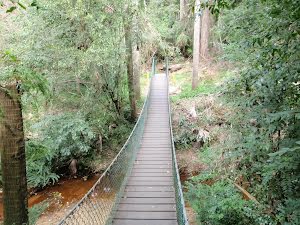
After another 110 m head up the surface|wood steps (about 3 m long)

Then cross the bridge (about 10 m long)

Then head down the surface|wood steps (about 3 m long)
|
|
|
After another 15 m (at the intersection of Bellbird Trail & Arboretum Trail) continue straight, to head along Arboretum Trail.

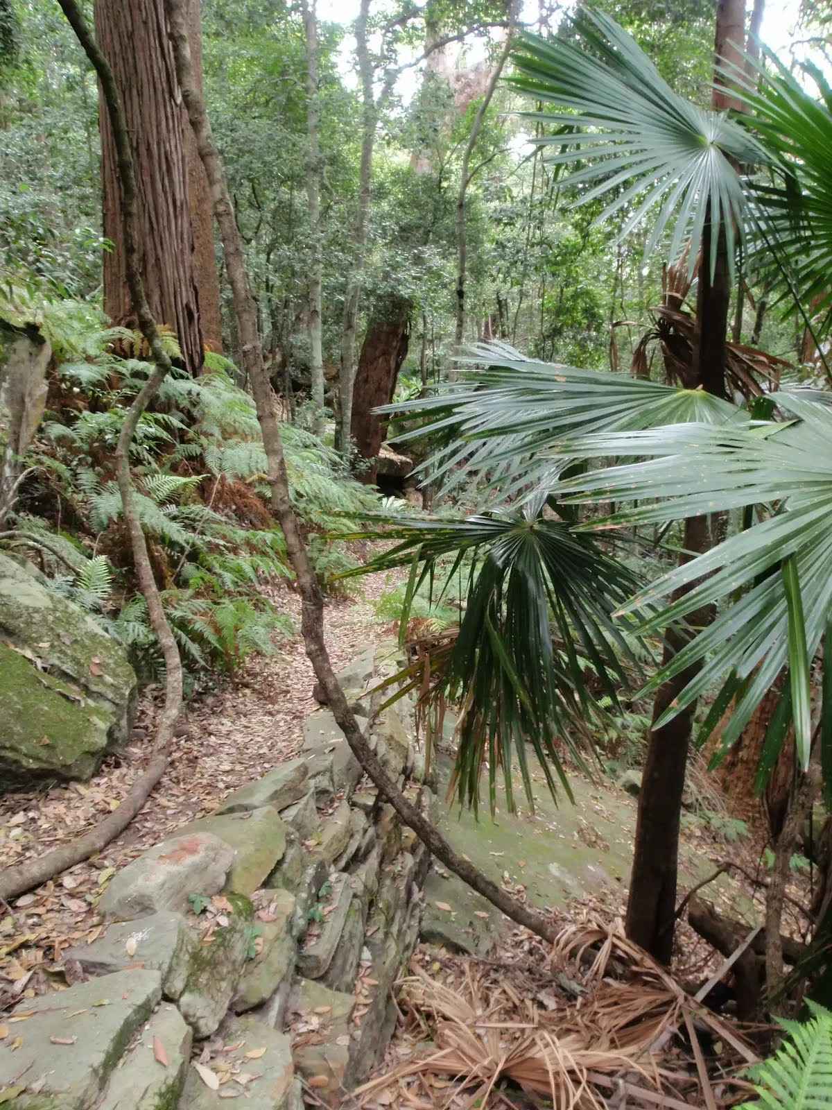
After another 210 m find the "Strickland State Forest Arboretum" (5 m on your left).
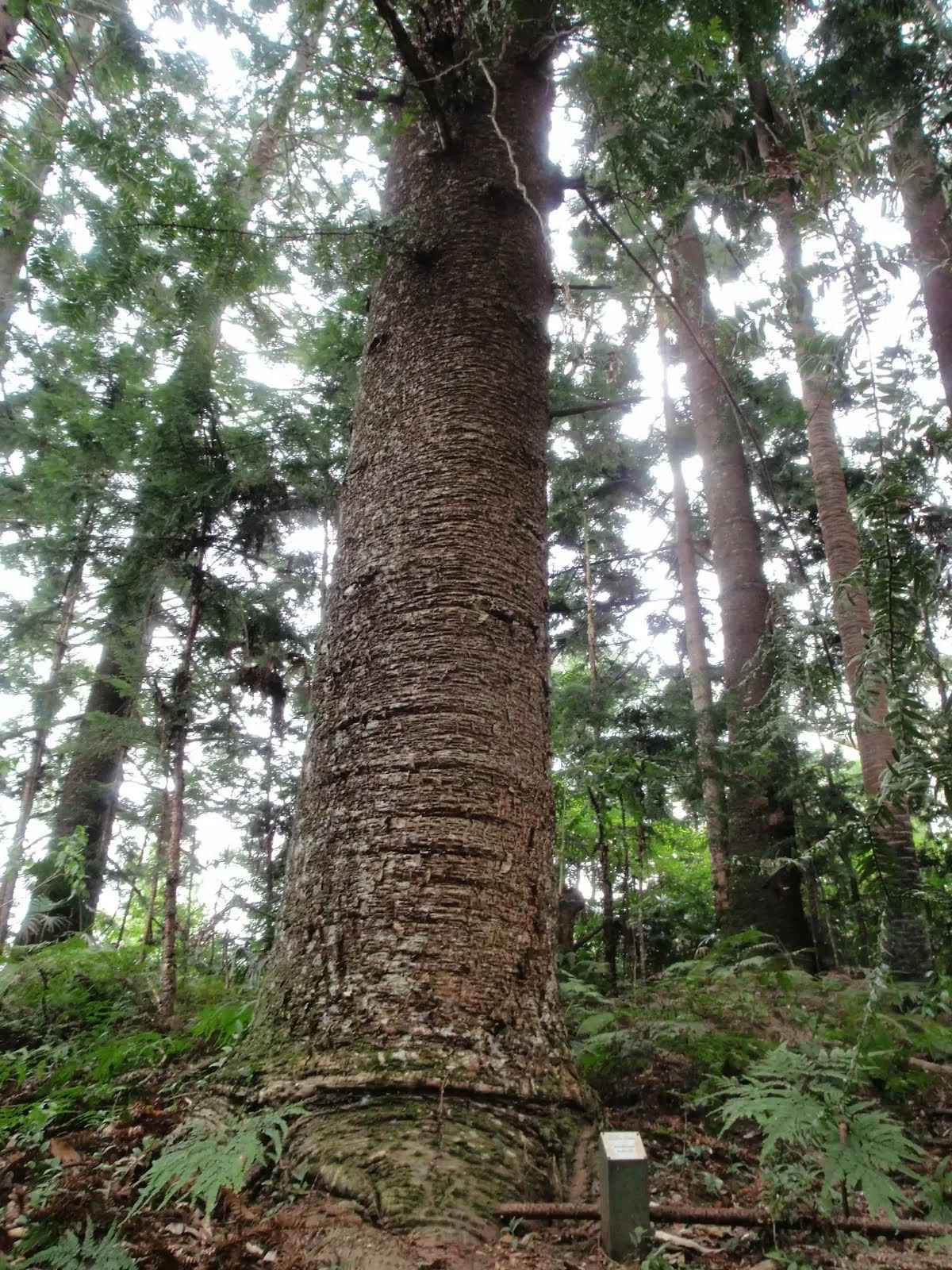
This arboretum is apparently one of the oldest in Australia, with plantings dating from 1887-1924. Numerous signs have been placed along the walking tracks to identify some of the species of trees. There are very tall, and impressive, examples of Hoop Pine, Bunya Pine, Tallow Wood and Red Cedar.
|
|
|

After another 325 m veer right.
|
|
|
After another 250 m continue straight.
|
|
|
After another 195 m veer left, to head along Bellbird Trail.
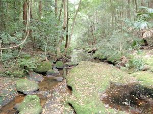
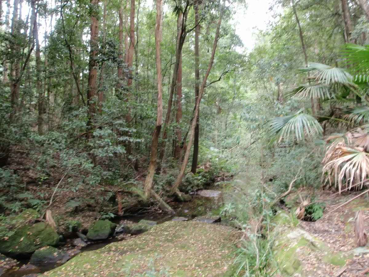
After another 550 m cross the ford.
Then find the "Bellbird Trail Narara crossing" (20 m on your left).
This picturesque crossing of Narara Creek is on the 'Bellbird Trail' in the Strickland State Forest. It is a great spot to break for a rest, or lunch, on your walk. There are no facilities, however, there are some steps and rocks to sit on while you soak up the scenery.
Then find the "Bellbirds" (on your left).
The Bellbird (more properly known as the Bell Miner) is a member of the Honeyeater family. These birds live and breed in large colonies, aggressively defending their territory. More often heard than seen, their call is described as a "Sweet, musical, bell-like 'tink'". They are 'mostly olive-green, with a short, down-curved, bright yellow bill, a red-orange bare eye patch and orange-yellow feet and legs'.
After another 420 m cross the ford.
|
|
|

After another 260 m (at the intersection of Arboretum Trail & Bellbird Trail) turn left, to head along Arboretum Trail.
|
|
|
After another 440 m (at the intersection of Arboretum Trail & Stoney Creek Trail) turn left, to head along Stoney Creek Trail.
|
|
|
After another 940 m (at the intersection of Cabbage Tree Trail & Stoney Creek Trail) turn left, to head along Cabbage Tree Trail.
After another 80 m find the "Cabbage-Tree Palm" (30 m on your right).
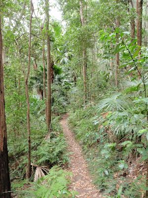
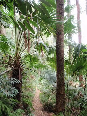
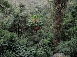
The Cabbage-Tree Palm (Livistona australis) is a tall, slender palm growing up to about 25 m in height and 0.35 m diameter. It is found in moist open forest, often in swampy sites and on margins of rainforests or near the sea. It is widely spread along the New South Wales coast and extends north into Queensland and southwards to eastern Victoria, growing further south than any other native Australian palm.
|
|
|
After another 265 m (at the intersection of Strickland Falls Trail & Cabbage Tree Trail) continue straight, to head along Strickland Falls Trail.
|
|
|

After another 690 m turn sharp right, to head along Strickland Falls Trail.

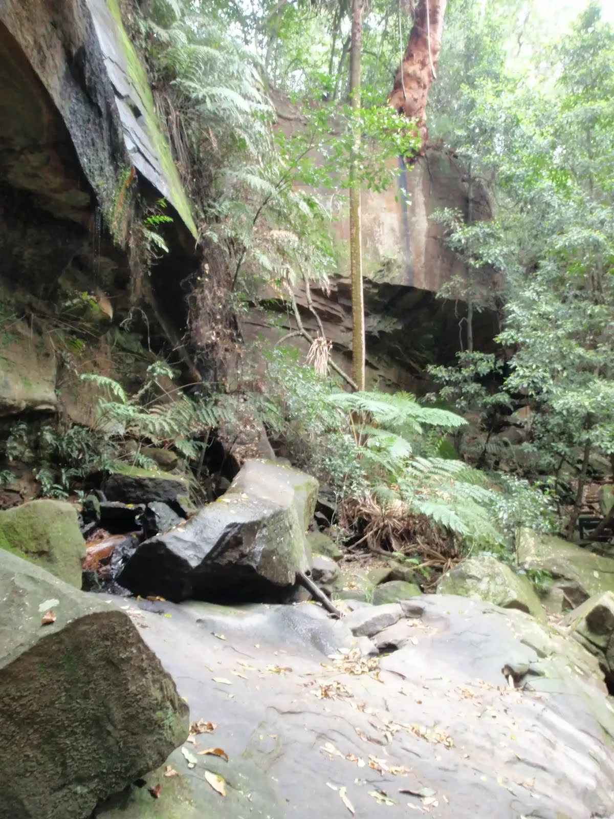
After another 35 m find the "Strickland Falls" (20 m on your left).
Strickland Falls are a short walk from the Banksia Picnic Area in the Strickland State Forest, Central Coast, NSW. The falls are often just a trickle, but will be more impressive after good rain. The scenery around the falls is still beautiful with moist rainforest scenery to enjoy.

After another 760 m pass the shelter (20 m on your left).
After another 25 m pass the car park (30 m on your left).
|
|
|
Turn right.
|
|
|
After another 65 m continue straight.

About 20 m past the end is a toilet. This toilet is wheelchair accessible.
|
|
|

The end.
About 15 m past the end is "Strickland State Forest".
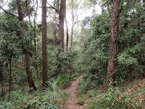
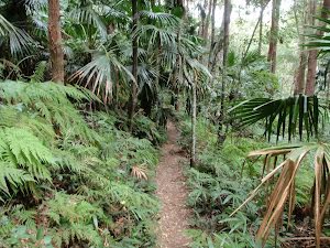
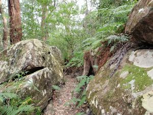
The Strickland State Forest, managed by State Forests of NSW, is located on the NSW Central Coast, close to the F3. The Strickland State Forest has a wide range of vegetation, including patches of rainforest along the sheltered creeks. The walking tracks take in some beautiful scenery, including a mixture of native forest and the remnants of an old arboretum. 'Strickland is no longer actively harvested and is managed for education and recreation purposes'. The 'Friends of Strickland' undertake projects including the construction of walking tracks. Note: Access into Strickland is during the daytime only with the entrance gate being unlocked between 7am and 5pm (Apr - Oct) and between 7am and 7pm (Nov - Mar)
|